From Engadget · Kari Paul · · 1m 40s
Deep-sea drones will map 98 percent of oceans by 2028
New underwater floats can survive crushing depths to fill a critical gap in climate data collection.
In brief
New underwater floats can survive crushing depths to fill a critical gap in climate data collection. Autonomous underwater drones designed to withstand extreme pressure at 6,000 meters will soon give scientists their first comprehensive view of the deep ocean, where 10 percent of warming occurs. Originally reported by…
Most of the ocean stays hidden
Over 70 percent of Earth is ocean, but the vast majority remains unexplored. As climate change warms waters, this blind spot becomes increasingly urgent.
Current floats miss the deepest warming
The Argo Program's 4,000 floats descend 2,000 to 4,000 meters, but 10 percent of ocean warming happens below these depths, leaving a major data gap.
France builds drones for the abyss
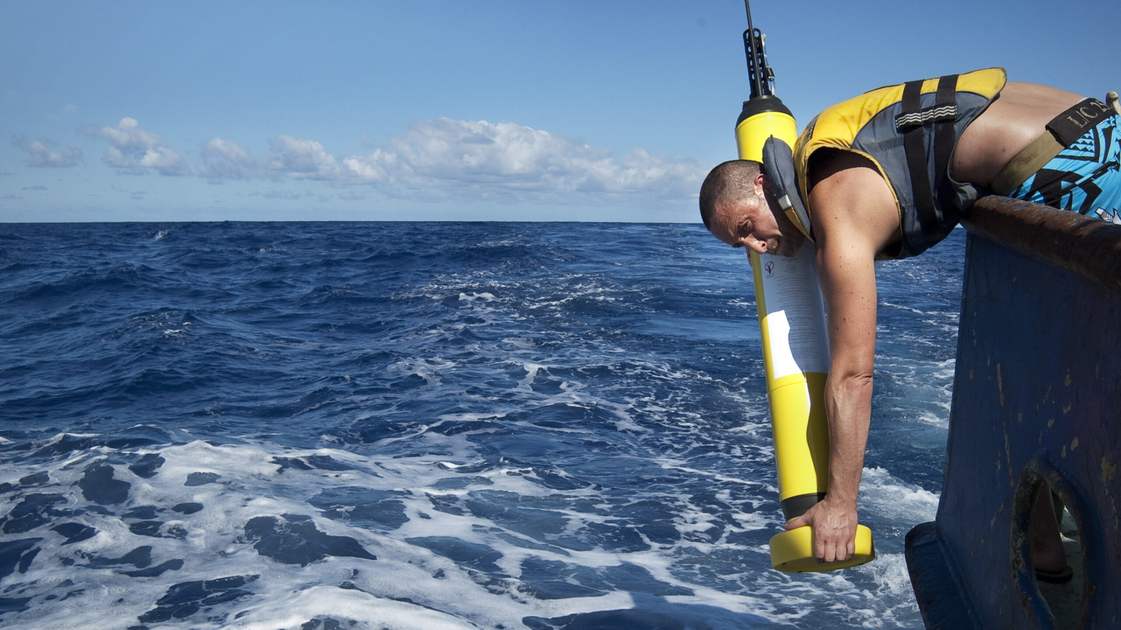
Ifremer's Deep-6000 prototypes completed five dives to 6,000 meters between January and February 2026, making France the third country after China and the US to reach these depths.
Extreme pressure demands new materials
At 6,000 meters, ocean pressure is 600 times greater than sea level. Ifremer used composite materials instead of pure titanium, making floats twice as heavy to withstand the force.
“The main challenge was to design a system that could withstand the pressures of the deep sea, be self-sufficient in terms of energy to remain operational for seven years, and keep costs under control.”
How the floats collect data
Each float runs ten-day cycles: drifting for nine days, profiling for three hours, then surfacing to transmit data via satellite. Batteries last about 150 cycles over three to five years.
Deep data improves climate forecasts
Floats measure temperature, salinity, oxygen and pressure. Current Argo data produces over 100,000 profiles yearly and helps predict monsoons, sea level rise and ocean circulation.
Thirty new floats complete the map
By 2028, 30 Deep-6000 floats will join the existing 4,000-float Argo fleet, covering 98 percent of ocean volume and revealing how deep waters store heat and carbon.
The key point
Autonomous underwater drones designed to withstand extreme pressure at 6,000 meters will soon give scientists their first comprehensive view of the deep ocean, where 10 percent of warming occurs.