From The Conversation · Ming Xiao · · 1m 10s
Arctic infrastructure built on frozen ground
Drones and digital twins spot permafrost thaw before damage.
In brief
Drones and digital twins spot permafrost thaw before damage. Permafrost thaw threatens Alaska infrastructure, with 80% of buildings at risk by 2090 if warming continues. Originally reported by The Conversation.
Wainwright's frozen foundation

Alaska town built on permafrost faces melting ice beneath roads and homes.
“A view of Wainwright, Alaska, which sits on low-lying coastal terrain underlain by permafrost”
Coastal bluffs eroding
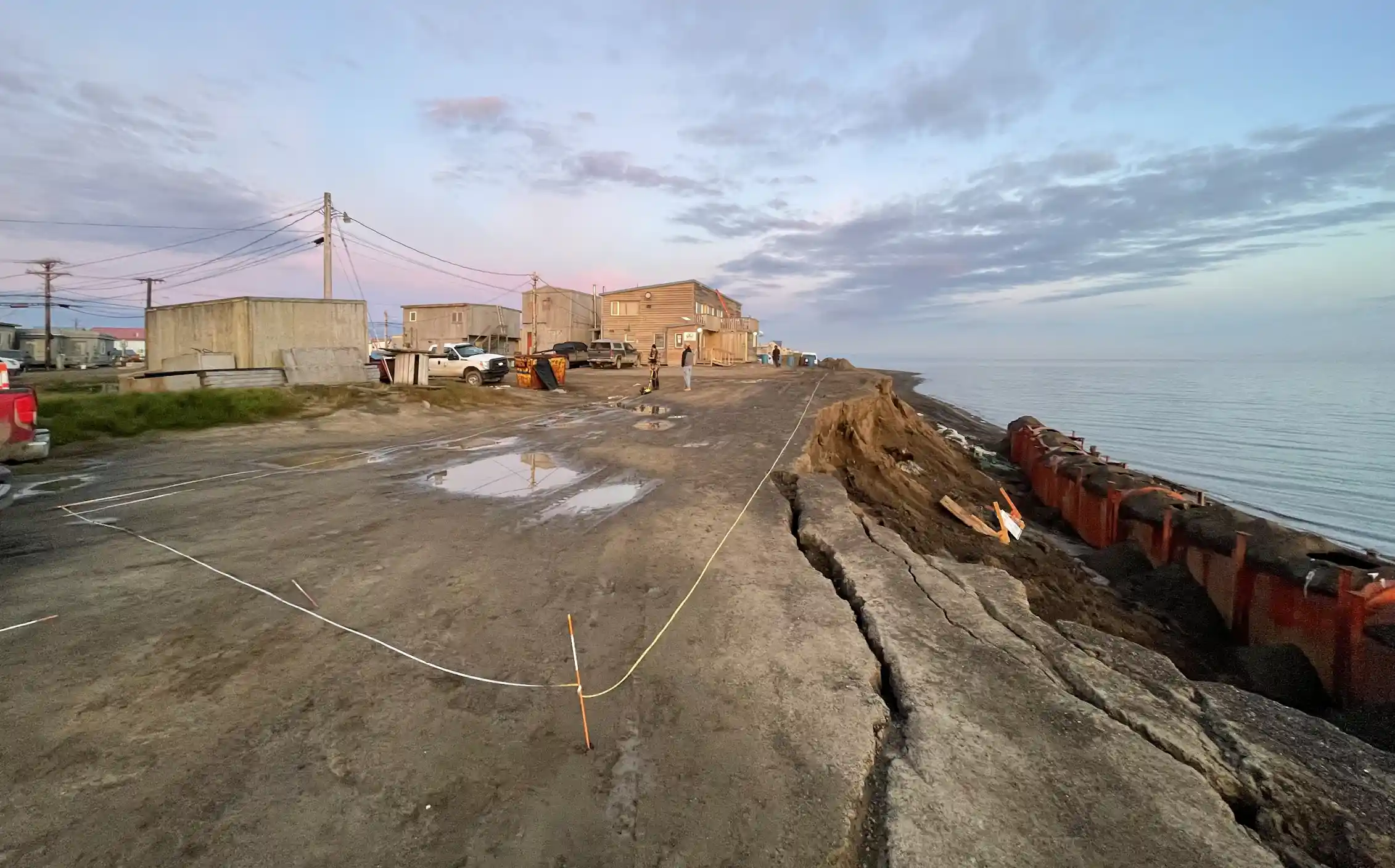
2024 bluff collapse in Utqiagvik brought eroding edge within meters of buildings.
“A coastal bluff failure in Utqiaġvik, Alaska, in August 2024 shows cracks and the narrow distance between the eroding edge and buildings”
Permafrost thaw risks
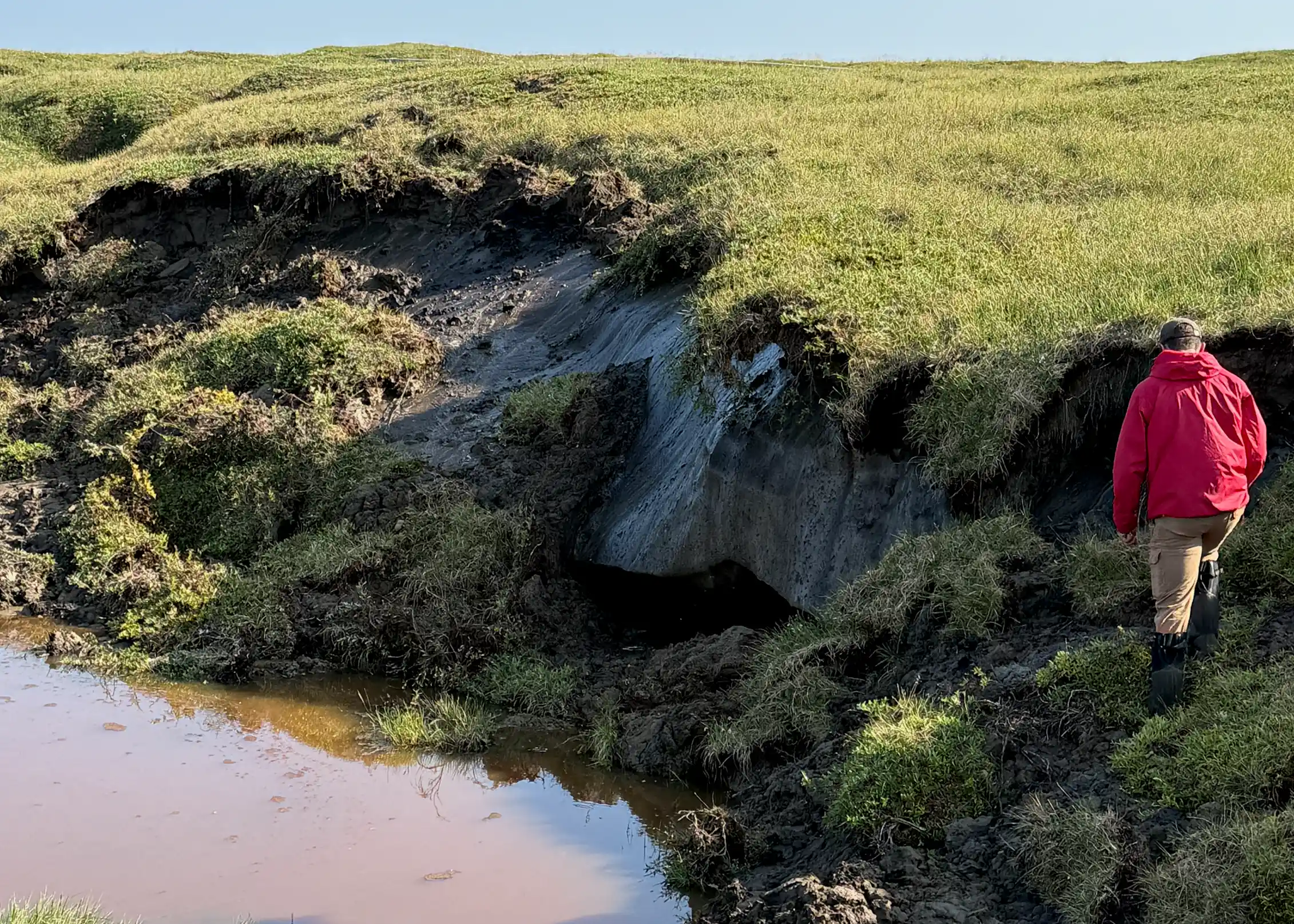
Melting permafrost causes roads to sink, buildings to tilt, and pipelines to crack.
“When ice within frozen ground, known as permafrost, melts, roads can sink, buildings can tilt, pipelines can crack and leak, and shorelines can retreat”
2025 cost estimate

Permafrost thaw could cost Alaska $37 billion to $51 billion in building and road damage.
“A study in 2025 estimated that permafrost thaw could cost Alaska US$37 billion to $51 billion just in building and road damage”
Drone surveying method
Drones carry electromagnetic sensors to map thawing ground without drilling.
“Researchers operate a drone-borne geophysical system over Arctic tundra near Utqiagvik, Alaska, in August 2024”
VLF-EM technology

Low frequency electromagnetic surveys detect thawed ground by measuring electrical conductivity.
“One method my team is working with is very low frequency electromagnetic surveying, or VLF-EM. It uses electromagnetic signals from distant transmitters and measures how the ground responds”
2026 risk projections
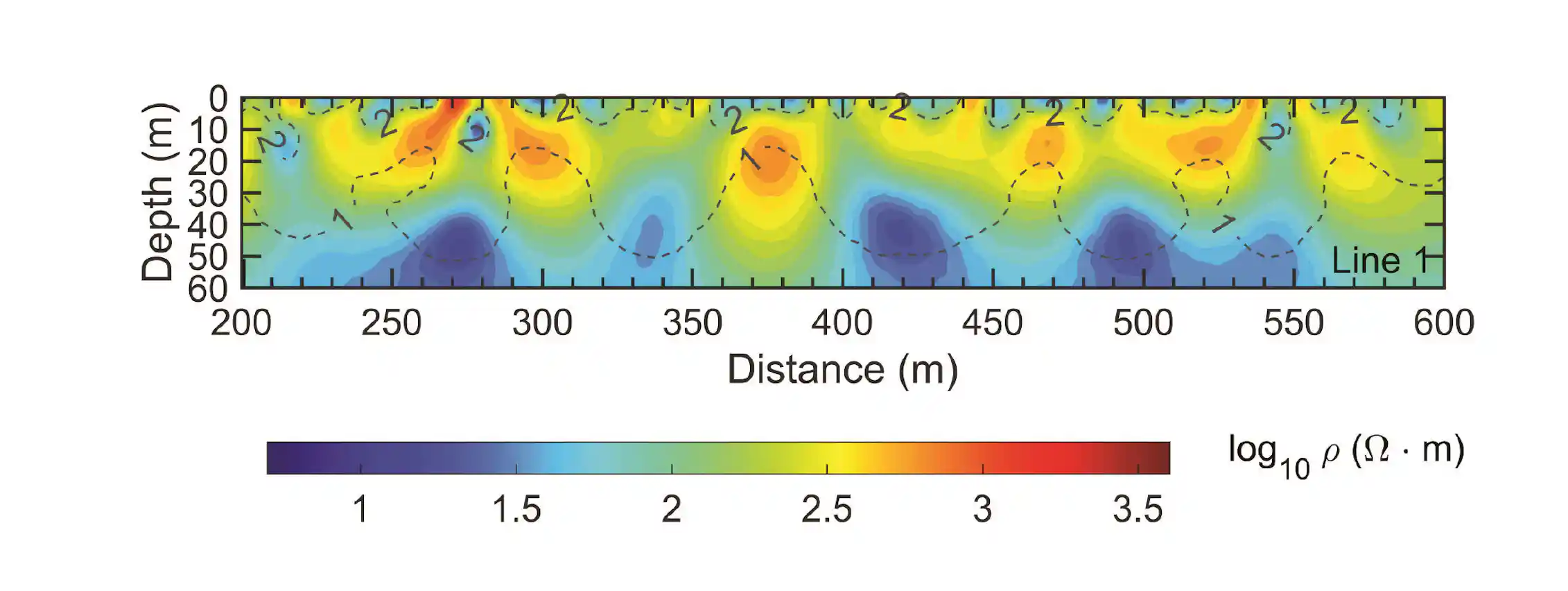
By 2090, 80% of buildings and 90% of pipelines face permafrost thaw damage.
“By the 2090s, about 80% of buildings, 60% of roads and 90% of pipelines are projected to be at risk of damage from sinking land”
Digital twin models

Computer models predict infrastructure damage from permafrost thaw using real-time data.
“We are also developing computer models called digital twins for monitoring cold regions’ infrastructure”
Future preparedness
Engineers need tools to forecast permafrost thaw risks decades ahead.
“Communities need easy-to-use tools showing where hazards may develop, how those hazards may change over coming decades, and what infrastructure could be affected”
Here's the gist
Permafrost thaw threatens Alaska infrastructure, with 80% of buildings at risk by 2090 if warming continues.